 |
Community Contact |
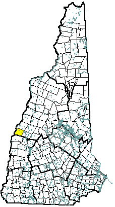
City of Lebanon
Carmela Hennessy, Zoning Director
51 North Park Street
Lebanon, NH
03766
|
| Telephone |
(603) 448-1457 |
| Fax |
(603) 442-6141 |
| E-mail |
carmela.hennessy@LebCity.com |
| Web Site |
www.lebnh.net
|
| Municipal Office Hours |
Monday through Friday, 8 am - 4:30 pm
|
| County |
Grafton |
| Labor Market Area |
Lebanon NH-VT Micro-NECTA, NH Portion |
| Tourism Region |
Dartmouth-Lake Sunapee |
| Planning Commission |
Upper Valley Lake Sunapee |
| Regional Development |
Grafton County Economic Development Council
|
| Election Districts |
|
| US Congress |
District 2 (All Wards) |
| Executive Council |
District 1 (All Wards) |
| State Senate |
District 5 (All Wards) |
| State Representative |
Grafton County District 13 (All Wards) |
| Incorporated: 1761 |
| Origin: The name Lebanon comes from the biblical cedars of ancient Lebanon, a Semitic word meaning white that refers to the nearby mountain with perpetual snows on its summit. Established in 1761, the name for this town was probably selected by the many early settlers who were from Lebanon, Connecticut, including Eleazar Wheelock, founder of Dartmouth College. Lebanon was the original location of the Indian Charity School from which Dartmouth is descended. In 1781, Lebanon was one of the towns that attempted to join Vermont, but later returned to New Hampshire. Lebanon was incorporated as a city in 1957. |
| Villages and Place Names: East Wilder, Mascoma, Sachem Village, West Lebanon |
| Population, Year of the First Census Taken: 1,180 residents in 1790 |
| Population Trends: Population change for Lebanon totaled 4,184 over 52 years, from 9,299 in 1960 to 13,483 in 2012. The largest decennial percent change was a 14 percent increase between 1970 and 1980; the smallest, a three percent increase between 1990 and 2000. The 2012 Census estimate for Lebanon was 13,483 residents, which ranked 22nd among New Hampshire's incorporated cities and towns. |
| Population Density and Land Area, 2010 (US Census Bureau): 326.2 persons per square mile of land area. Lebanon contains 40.3 square miles of land area and 1.0 square miles of inland water area. |
| MUNICIPAL SERVICES |
| Type of Government |
Manager & Council |
| Budget: Municipal Appropriations, 2013 |
$46,216,150 |
| Budget: School Appropriations, 2013 |
$37,506,871 |
| Zoning Ordinance |
1936/13 |
| Master Plan |
2012 |
| Capitol Improvement Plan |
Yes |
| Industrial Plans Reviewed By |
Planning Board |
| Boards and Commissions | |
| Elected: | City Council |
| Appointed: | Planning; Zoning; Library; Conservation; Heritage |
| Public Library |
Lebanon Public; West Lebanon |
| EMERGENCY SERVICES |
| Police Department |
Full-time |
| Fire Department |
Municipal |
| Emergency Medical Service |
Municipal |
| Nearest Hospital(s) |
Distance |
Staffed Beds |
| Dartmouth-Hitchcock Med Ctr, Lebanon |
Local |
388 |
| Alice Peck Day Memorial, Lebanon |
Local |
25 |
|
|
|
| UTILITIES |
| Electric Supplier |
Liberty Utilities; NH Electric Coop |
| Natural Gas Supplier |
None |
| Water Supplier |
Municipal |
| Sanitation |
Municipal |
| Municipal Wastewater Treatment Plant |
Yes |
| Solid Waste Disposal |
| Curbside Trash Pickup | Private |
| Pay-As-You-Throw Program | Yes |
| Recycling Program | Volunraty |
| Telephone Company |
Fairpoint |
| Cellular Telephone Access |
Yes |
| Cable Television Access |
Yes |
| Public Access Television Station |
Yes |
| High Speed Internet Service: |
| Business | Yes |
| Residential | Limited |
| (NH Dept. of Revenue Adminstration) PROPERTY TAXES |
| 2012 Total Tax Rate (per $1,000 of value) |
$24.19 |
| 2012 Equalization Ratio |
100.0 |
| 2012 Full Value Tax Rate (per $1,000 of value) |
$23.66 |
| 2012 Percent of Local Assessed Value by Property Type |
| Residential Land and Buildings | 54.7% |
| Commercial Land and Buildings | 40.7% |
| Public Utilities, Current Use, and Other | 4.7% |
| (ACS 2008-2012) HOUSING |
| Total Housing Units |
6,271 |
| Single-Family Units, Detached or Attached |
3,216 |
| Units in Multiple-Family Structures: |
|
| Two to Four Units in Structure |
1,028 |
| Five or More Units in Structure |
1,912 |
| Mobile Homes and Other Housing Units |
115 |
| (US Census Bureau) DEMOGRAPHICS |
| Total Population |
Community |
County |
| 2012 |
13,483 |
89,181 |
| 2010 |
13,151 |
89,118 |
| 2000 |
12,571 |
81,826 |
| 1990 |
12,191 |
74,998 |
| 1980 |
11,134 |
65,806 |
| 1970 |
9,725 |
54,914 |
| |
| Demographics, American Community Survey (ACS) 2008-2012 |
| Population by Gender |
| Male: 6,568 |
|
Female: 6,707 |
| Population by Age Group |
| Under age 5 |
|
724 |
| Age 5 to 19 |
|
2,061 |
| Age 20 to 34 |
|
3,150 |
| Age 35 to 54 |
|
3,359 |
| Age 55 to 64 |
|
1,952 |
| Age 65 and over |
|
2,029 |
| Median Age |
|
39 years |
| Educational Attainment, population 25 years and over |
| High school graduate or higher |
|
91.9% |
| Bachelor's degree or higher |
|
45.5% |
(ACS 2008-2012) ANNUAL INCOME, 2012
(Inflation Adjusted Dollars) |
| Per capita income |
$33,437 |
| Median family income |
$76,615 |
| Median household income |
$54,628 |
| Median Earnings, full-time, year-round workers |
| Male |
$52,288 |
| Female |
$42,165 |
| Individuals below the poverty level |
10.5% |
| (NHES - ELMI) LABOR FORCE |
| Annual Average |
2002 |
2012 |
| Civilian Labor Force |
7,657 |
8,252 |
| Employed |
7,481 |
7,962 |
| Unemployed |
176 |
290 |
| Unemployment Rate |
2.3% |
3.5% |
| (NHES - ELMI) EMPLOYMENT & WAGES |
| Annual Average Covered Employment |
2002 |
2012 |
| Goods Producing Industries |
| Average Employment |
2,448 |
1,868 |
| Average Weekly Wage |
$826 |
$1,225 |
| |
|
|
| Service Providing Industries |
| Average Employment |
14,180 |
15,794 |
| Average Weekly Wage |
$760 |
$1,127 |
| |
|
|
| Total Private Industry |
| Average Employment |
16,628 |
17,663 |
| Average Weekly Wage |
$770 |
$1,138 |
| |
|
|
| Government (Federal, State, and Local) |
| Average Employment |
862 |
836 |
| Average Weekly Wage |
$611 |
$919 |
| |
|
|
| Total, Private plus Government |
| Average Employment |
17,491 |
18,499 |
| Average Weekly Wage |
$762 |
$1,128 |
| n = indicates that the data does not meet disclosure standards |
| (NH Dept. of Education) EDUCATION/CHILD CARE FACILITIES |
| Schools students attend: |
Lebanon operates grades K-12 |
SAU 88 |
| Career Technology Center(s): |
Hartford Area Career and Technical Center, White River Junction VT |
Region: 7 |
| Educational Facilities |
Elementary |
Middle/Junior High |
High School |
Private/Parochial |
| Number of Schools |
2 |
1 |
2 |
|
| Grade Levels |
P K 1-5 |
5-8 |
9-12 |
|
| Total Enrollment |
587 |
454 |
725 |
|
| 2013 NH Licensed Child Care Facilities (Bureau of Child Care Licensing): |
Total Facilities: 12 |
Total Capacity: 467 |
| Nearest Community/Technical College: River Valley |
| Nearest Colleges or Universities: Dartmouth; Colby-Sawyer; Lebanon |
| LARGEST BUSINESSES |
PRODUCT/SERVICE |
EMPLOYEES |
ESTABLISHED |
| Dartmouth Hitchcock Medical Center/Hitchcock Clinic |
Health care services |
6,652 |
1857 |
| Timkin |
Ball & roller bearings |
433 |
1926 |
| Lebanon School District |
Education |
364 |
1926 |
| Thermal Dynamics |
Plasma cutting torches |
183 |
|
| Alice Peck Day/Lifecare Center |
Health care services |
595 |
|
| Fuji Film Dimatix |
Technology |
202 |
|
| TomTom |
Mapping |
335 |
|
| Luminescent Systems, Inc. |
Electroluminescent lighting |
187 |
1974 |
| Hypertherm |
Manufacturing |
529 |
1958 |
| City of Lebanon |
Municipal |
182 |
|
| (Distance estimated from city/town hall) TRANSPORTATION |
| Road Access |
US Routes |
4 |
|
State Routes |
10, 12A, 4A, 120 |
| Nearest Interstate, Exit |
I-89, Exits 17 - 20 |
|
Distance |
Local access |
| Railroad |
CCRR |
| Public Transportation |
Advance Transit |
| |
| Nearest Public Use Airport, General Aviation |
| Lebanon Municipal |
| Runway |
5,496 ft. asphalt |
| Lighted? |
Yes |
Navigational Aids? |
Yes |
| Nearest Airport with Scheduled Service |
| Lebanon Municipal |
Distance |
Local |
| Number of Passsenger Airlines Serving Airport |
1 |
| |
| Driving distance to selected cities: |
| Manchester, NH |
71 miles |
| Portland, ME |
157 miles |
| Boston, MA |
122 miles |
| New York City, NY |
269 miles |
| Montreal, Quebec |
188 miles |
| (ACS 2008-2012) COMMUTING TO WORK |
| Workers 16 years and over |
|
| Drove alone, car/truck/van |
74.9% |
| Carpooled, car/truck/van |
8.2% |
| Public transportation |
4.6% |
| Walked |
2.2% |
| Other Means |
3.5% |
| Worked at home |
6.6% |
| Mean Travel Time to Work |
15.6 minutes |
| |
| Percent of Working Residents: |
(ACS 2008-2012) |
| Working in community of residence |
66.5% |
| Commuting to another NH community |
22.4% |
| Commuting out-of-state |
11.1% |
| RECREATION, ATTRACTIONS, AND EVENTS |
| Municipal Parks |
| YMCA/YWCA |
| Boys Club/Girls Club |
| Golf Courses |
| Swimming: Indoor Facility |
| Swimming: Outdoor Facility |
| Tennis Courts: Indoor Faclity |
| Tennis Courts: Outdoor Facility |
| Ice Skating Rink: Indoor Facility |
| Bowling Facilities |
| Museums |
| Cinemas |
| Performing Arts Facilities |
| Tourists Attractions |
| Youth Organizations (i.e., Scouts, 4-H) |
| Youth Sports: Baseball |
| Youth Sports: Soccer |
| Youth Sports: Football |
| Youth Sports: Basketball |
| Youth Sports: Hockey |
| Campgrounds |
| Fishing/Hunting |
| Boating/Marinas |
| Snowmobile Trails |
| Bicycle Trails |
| Cross Country Skiing |
| Beach or Waterfront Recreational Area |
| Overnight or Day Camps |
| |
|
|
Nearest Ski Area(s): Storrs Hill |
| |
|
|
Other: Hiking Trails; Lebanon Adult Sports; Backcountry Camping |
|