 |
Community Contact |
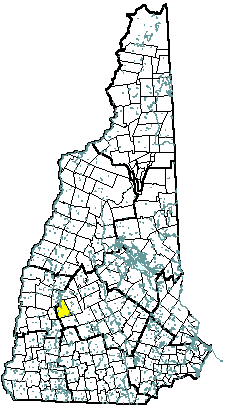
Town of Newbury
Dennis J. Pavlicek, Town Administrator
PO Box 296
Newbury, NH
03255
|
| Telephone |
(603) 763-4940 |
| Fax |
(603) 763-5298 |
| E-mail |
townadmin@newburynh.org |
| Web Site |
www.newburynh.org/
|
| Municipal Office Hours |
Selectmen: Monday, Tuesday, Thursday, Friday, 8 am - 12 noon; Town Clerk: Monday, 1 pm - 7 pm, Tuesday through Friday, 8 am - 4 pm
|
| County |
Merrimack |
| Labor Market Area |
New London NH LMA |
| Tourism Region |
Dartmouth-Lake Sunapee |
| Planning Commission |
Upper Valley Lake Sunapee |
| Regional Development |
Capital Regional Development Council
|
| Election Districts |
|
| US Congress |
District 2 |
| Executive Council |
District 2 |
| State Senate |
District 8 |
| State Representative |
Merrimack County District 5 |
| Incorporated: 1778 |
| Origin: Situated at the south end of Lake Sunapee, this town has had many names. The original grant by the Masonian Proprietors in 1753 named it Dantzic, after the Baltic seaport. A separate grant on adjoining land, the first provincial grant in 1754, was called Hereford, in honor of Edward Devereaux, Viscount Hereford. The grant was renewed in 1772 as Fishersfield, after Governor John Wentworth's brother-in-law John Fisher, and included both the Dantzic and Hereford grants. Fishersfield was incorporated in 1778 upon request of residents. The name was changed to Newbury in 1837, as suggested by settlers originally from Newbury, Massachusetts. |
| Villages and Place Names: Blodgett Landing, Edgemont, Mount Sunapee, Pine Cliff, South Newbury, Box Corner, Chalk Pond |
| Population, Year of the First Census Taken: 331 residents in 1790 |
| Population Trends: Population change for Newbury totaled 1,759 over 52 years, from 342 in 1960 to 2,101 in 2012. The largest decennial percent change was an 89 percent increase between 1970 and 1980, following a 49 percent increase between 1960 and 1970. The 2012 Census estimate for Newbury was 2,101 residents, which ranked 136th among New Hampshire's incorporated cities and towns. |
| Population Density and Land Area, 2010 (US Census Bureau): 57.7 persons per square mile of land area. Newbury contains 35.9 square miles of land area and 2.3 square miles of inland water area. |
| MUNICIPAL SERVICES |
| Type of Government |
Selectmen |
| Budget: Municipal Appropriations, 2013 |
$3,982,002 |
| Budget: School Appropriations, |
Not Available |
| Zoning Ordinance |
1958/11 |
| Master Plan |
2008 |
| Capitol Improvement Plan |
Yes |
| Industrial Plans Reviewed By |
Planning Board |
| Boards and Commissions | |
| Elected: | Selectmen; Planning; Zoning; Library; Cemetery; Trust Funds |
| Appointed: | Conservation; Recreation |
| Public Library |
Newbury Public |
| EMERGENCY SERVICES |
| Police Department |
Full-time |
| Fire Department |
Part-time |
| Emergency Medical Service |
Part-time |
| Nearest Hospital(s) |
Distance |
Staffed Beds |
| New London Hospital, New London |
8 miles |
25 |
|
|
|
|
|
|
| UTILITIES |
| Electric Supplier |
PSNH |
| Natural Gas Supplier |
None |
| Water Supplier |
Chalk Pond; private wells |
| Sanitation |
Municipal |
| Municipal Wastewater Treatment Plant |
Yes |
| Solid Waste Disposal |
| Curbside Trash Pickup | None |
| Pay-As-You-Throw Program | No |
| Recycling Program | Voluntary |
| Telephone Company |
Fairpoint; TDS Telecom |
| Cellular Telephone Access |
Limited |
| Cable Television Access |
Yes |
| Public Access Television Station |
Yes |
| High Speed Internet Service: |
| Business | Limited |
| Residential | Limited |
| (NH Dept. of Revenue Adminstration) PROPERTY TAXES |
| 2012 Total Tax Rate (per $1,000 of value) |
$14.61 |
| 2012 Equalization Ratio |
100.0 |
| 2012 Full Value Tax Rate (per $1,000 of value) |
$14.62 |
| 2012 Percent of Local Assessed Value by Property Type |
| Residential Land and Buildings | 94.7% |
| Commercial Land and Buildings | 4.4% |
| Public Utilities, Current Use, and Other | 0.8% |
| (ACS 2008-2012) HOUSING |
| Total Housing Units |
1,563 |
| Single-Family Units, Detached or Attached |
1,503 |
| Units in Multiple-Family Structures: |
|
| Two to Four Units in Structure |
54 |
| Five or More Units in Structure |
0 |
| Mobile Homes and Other Housing Units |
6 |
| (US Census Bureau) DEMOGRAPHICS |
| Total Population |
Community |
County |
| 2012 |
2,101 |
146,761 |
| 2010 |
2,072 |
146,445 |
| 2000 |
1,712 |
136,716 |
| 1990 |
1,351 |
120,618 |
| 1980 |
961 |
98,302 |
| 1970 |
509 |
80,925 |
| |
| Demographics, American Community Survey (ACS) 2008-2012 |
| Population by Gender |
| Male: 1,044 |
|
Female: 1,059 |
| Population by Age Group |
| Under age 5 |
|
121 |
| Age 5 to 19 |
|
368 |
| Age 20 to 34 |
|
215 |
| Age 35 to 54 |
|
629 |
| Age 55 to 64 |
|
355 |
| Age 65 and over |
|
415 |
| Median Age |
|
46 years |
| Educational Attainment, population 25 years and over |
| High school graduate or higher |
|
94.8% |
| Bachelor's degree or higher |
|
38.3% |
(ACS 2008-2012) ANNUAL INCOME, 2012
(Inflation Adjusted Dollars) |
| Per capita income |
$34,079 |
| Median family income |
$80,341 |
| Median household income |
$66,875 |
| Median Earnings, full-time, year-round workers |
| Male |
$59,135 |
| Female |
$40,982 |
| Individuals below the poverty level |
9.3% |
| (NHES - ELMI) LABOR FORCE |
| Annual Average |
2002 |
2012 |
| Civilian Labor Force |
1,063 |
1,157 |
| Employed |
1,031 |
1,112 |
| Unemployed |
32 |
45 |
| Unemployment Rate |
3.0% |
3.9% |
| (NHES - ELMI) EMPLOYMENT & WAGES |
| Annual Average Covered Employment |
2002 |
2012 |
| Goods Producing Industries |
| Average Employment |
16 |
n |
| Average Weekly Wage |
$541 |
n |
| |
|
|
| Service Providing Industries |
| Average Employment |
409 |
n |
| Average Weekly Wage |
$292 |
n |
| |
|
|
| Total Private Industry |
| Average Employment |
425 |
493 |
| Average Weekly Wage |
$301 |
$411 |
| |
|
|
| Government (Federal, State, and Local) |
| Average Employment |
267 |
62 |
| Average Weekly Wage |
$501 |
$485 |
| |
|
|
| Total, Private plus Government |
| Average Employment |
457 |
555 |
| Average Weekly Wage |
$320 |
$419 |
| n = indicates that the data does not meet disclosure standards |
| (NH Dept. of Education) EDUCATION/CHILD CARE FACILITIES |
| Schools students attend: |
Grades K-12 are part of Kearsarge Regional (Bradford, Newbury, New London, Springfield, Sutton, Warner, Wilmot) |
SAU 65 |
| Career Technology Center(s): |
Sugar River Valley RTC, Claremont or Newport |
Region: 10 |
| Educational Facilities |
Elementary |
Middle/Junior High |
High School |
Private/Parochial |
| Number of Schools |
|
|
|
|
| Grade Levels |
|
|
|
|
| Total Enrollment |
|
|
|
|
| 2013 NH Licensed Child Care Facilities (Bureau of Child Care Licensing): |
Total Facilities: 0 |
Total Capacity: 0 |
| Nearest Community/Technical College: River Valley |
| Nearest Colleges or Universities: Colby-Sawyer; Magdalen |
| LARGEST BUSINESSES |
PRODUCT/SERVICE |
EMPLOYEES |
ESTABLISHED |
| Mount Sunapee Resort |
Recreation area |
150+ |
1947 |
| Baker Hill Golf Club |
Golf Course |
20+ |
2002 |
| Best Western Sunapee Lake Lodge |
Motel |
25 |
2000 |
|
|
|
|
|
|
|
|
|
|
|
|
|
|
|
|
|
|
|
|
|
|
|
|
|
|
|
|
| (Distance estimated from city/town hall) TRANSPORTATION |
| Road Access |
US Routes |
|
|
State Routes |
103, 103A, 103B |
| Nearest Interstate, Exit |
I-89, Exits 12 - 12A |
|
Distance |
8 miles; 10 miles |
| Railroad |
No |
| Public Transportation |
No |
| |
| Nearest Public Use Airport, General Aviation |
| Parlin Field, Newport |
| Runway |
3,450 ft. asphalt |
| Lighted? |
No |
Navigational Aids? |
No |
| Nearest Airport with Scheduled Service |
| Lebanon Municipal |
Distance |
34 miles |
| Number of Passsenger Airlines Serving Airport |
1 |
| |
| Driving distance to selected cities: |
| Manchester, NH |
47 miles |
| Portland, ME |
132 miles |
| Boston, MA |
97 miles |
| New York City, NY |
270 miles |
| Montreal, Quebec |
218 miles |
| (ACS 2008-2012) COMMUTING TO WORK |
| Workers 16 years and over |
|
| Drove alone, car/truck/van |
82.7% |
| Carpooled, car/truck/van |
6.7% |
| Public transportation |
0.0% |
| Walked |
2.1% |
| Other Means |
2.1% |
| Worked at home |
6.4% |
| Mean Travel Time to Work |
34.2 minutes |
| |
| Percent of Working Residents: |
(ACS 2008-2012) |
| Working in community of residence |
18.0% |
| Commuting to another NH community |
72.0% |
| Commuting out-of-state |
10.0% |
| RECREATION, ATTRACTIONS, AND EVENTS |
| Municipal Parks |
| YMCA/YWCA |
| Boys Club/Girls Club |
| Golf Courses |
| Swimming: Indoor Facility |
| Swimming: Outdoor Facility |
| Tennis Courts: Indoor Faclity |
| Tennis Courts: Outdoor Facility |
| Ice Skating Rink: Indoor Facility |
| Bowling Facilities |
| Museums |
| Cinemas |
| Performing Arts Facilities |
| Tourists Attractions |
| Youth Organizations (i.e., Scouts, 4-H) |
| Youth Sports: Baseball |
| Youth Sports: Soccer |
| Youth Sports: Football |
| Youth Sports: Basketball |
| Youth Sports: Hockey |
| Campgrounds |
| Fishing/Hunting |
| Boating/Marinas |
| Snowmobile Trails |
| Bicycle Trails |
| Cross Country Skiing |
| Beach or Waterfront Recreational Area |
| Overnight or Day Camps |
| |
|
|
Nearest Ski Area(s): Mount Sunapee |
| |
|
|
Other: Fells Historic Site; Stoney Brook Sanctuary; NH Craftsman Fair |
|